
Configuration – Geofencing
Geofencing auto-detects vehicle arrivals/departures via virtual boundaries, improving ETA accuracy, stop updates and reducing manual input.
Table of contents
What is geofencing?
Geofencing is a feature that automatically detects when vehicles enter or exit defined geographical areas around locations. It creates virtual boundaries (typically circular areas with a customizable radius) around stop locations. These boundaries provide more accurate arrival and departure timestamps without relying solely on driver input.
Benefits of geofencing
- More reliable stop updates
- Improved accuracy of stop arrival and departure through autocomplete
- Improved ETA calculations
- Fewer manual updates
- Fewer calls between driver and office to report arrivals
How does Qargo use geofencing?
-
Geofences trigger “Arrived at location” and “Departed at location”.
-
Geofences are defined by a circle radius around the location.
- This is defined on the tenant and on the location.
-
The stop is completed when the geofence associated with the location is triggered.
-
Once the stop is completed (green), Qargo logs the events and records the times.
Configuration
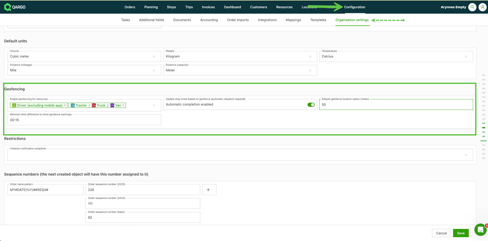
At the tenant level, the following values can be configured for geofencing:
- Enable geofencing for resources: defines which types of resources have geofencing enabled or disabled.
- Update stop times based on geofence: automatically completes the stop once the enabled resource triggers the geofence radius.
- Default geofence location radius (meter): defines the default size of the geofencing area. This can also be overridden at the location level.
-
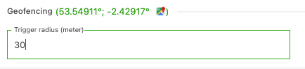
Locations: a radius can be defined that overrides the radius defined at the tenant level.
-
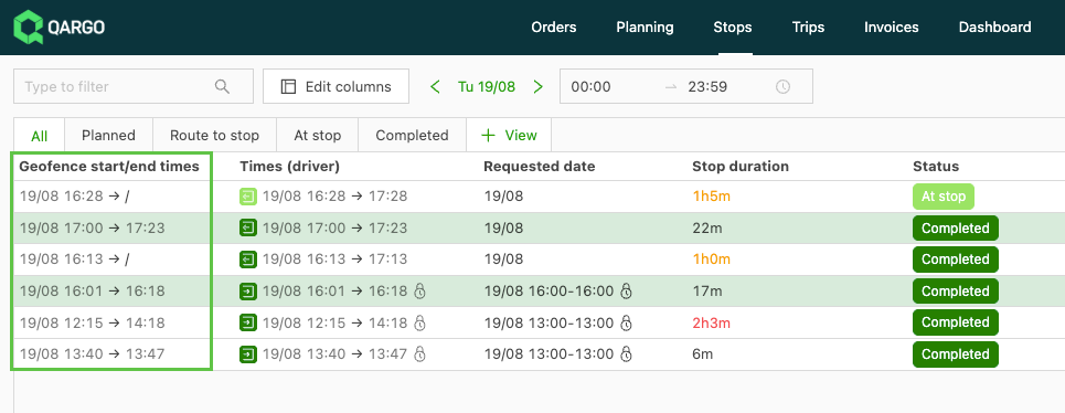
Click the Customize button to enable the column in the Stops view.
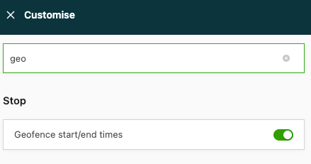
View geofence times in the Stops view.
Autocompleting stops
-
The load must be fully dispatched to the driver.

-
Arrival and departure at stops are completed automatically based on geofenced areas.
-
The driver mobile app is only supported when used together with a telematics system.
-
The previous stop must be completed before the stop can be autocompleted.
- If the previous stop was not successfully completed, geofence times are still captured, but the stop is not completed.
-
If autocomplete geofencing is used to depart from a stop, the stop is marked as completed.
- In the driver mobile app, the question path is not shown to the driver automatically.
- The driver can still update the information for the completed stop.
Arrival at stop
-
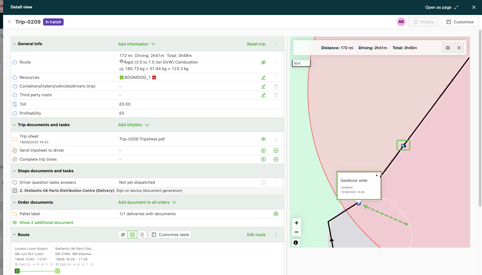
When the driver enters the geofence area, arrival is completed automatically.
- In the driver mobile app, the Arrive step of the stop is completed.
- The date and time stamp for arrival is logged.
- If no arrival is detected by the geofence, the driver must arrive manually to complete the task.
Departure from stop
-
Departure from the stop is completed when the vehicle leaves the location and passes through the geofence.
- In the driver mobile app, the driver typically completes the Depart step already. In that case, the geofence is kept as a backup.
Polygon geofences: follow the outline of a site
As mentioned above, geofencing records when a vehicle arrives at and leaves a stop, and it can complete the stop automatically. By default, the geofence is a circle around the stop’s location.
On large or irregular sites, such as a port terminal, a circle also covers nearby roads and neighboring sites. Passing traffic can then complete a stop, or complete it at the wrong site. A polygon geofence follows the outline of the site instead.
Each location has one geofence: a single closed shape, with no holes and no separate areas. If customers share a location, they also share its geofence.
Polygon geofence: draw, change or remove
- Open the location under Locations > Locations.
- Locate the Geofencing section.
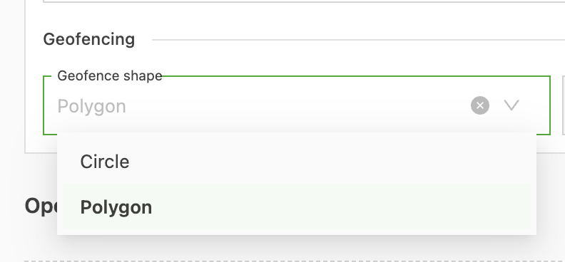
- Select Polygon in the Geofence shape field. Trigger radius (meter) is grayed out.
- Click the map to place each corner of the outline, then double-click to finish. The outline turns red and the Adjust geofence button appears above the map. Geofences of neighboring locations are not shown while drawing.
- Save the location.
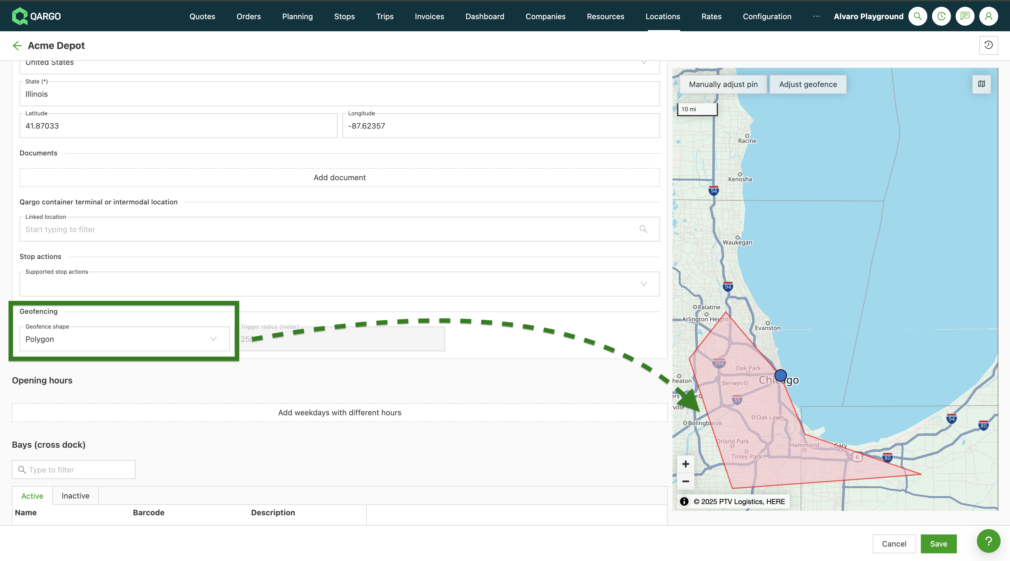
To change the outline, click Adjust geofence and draw it again, because corners cannot be dragged. To keep the saved outline, click Cancel.
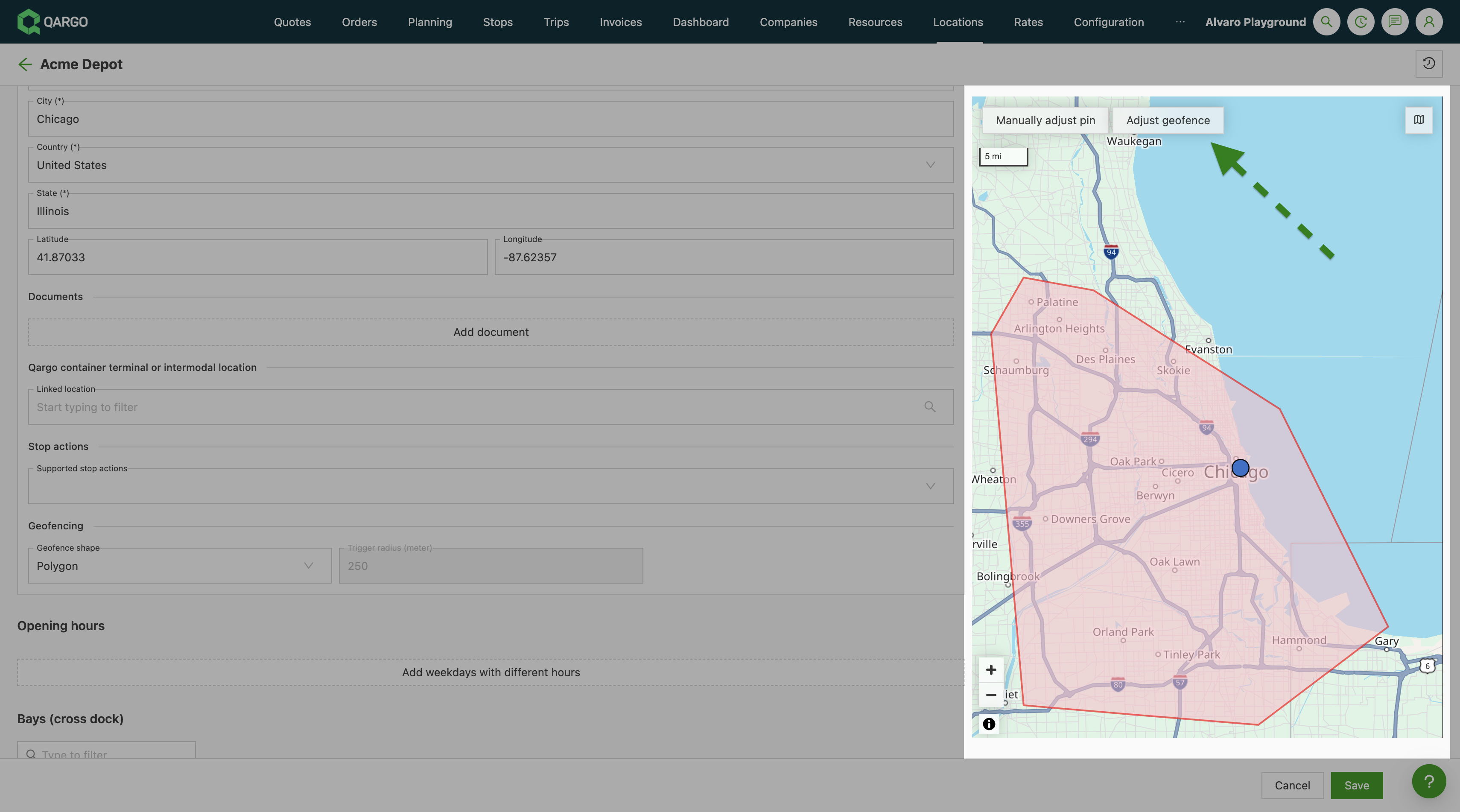
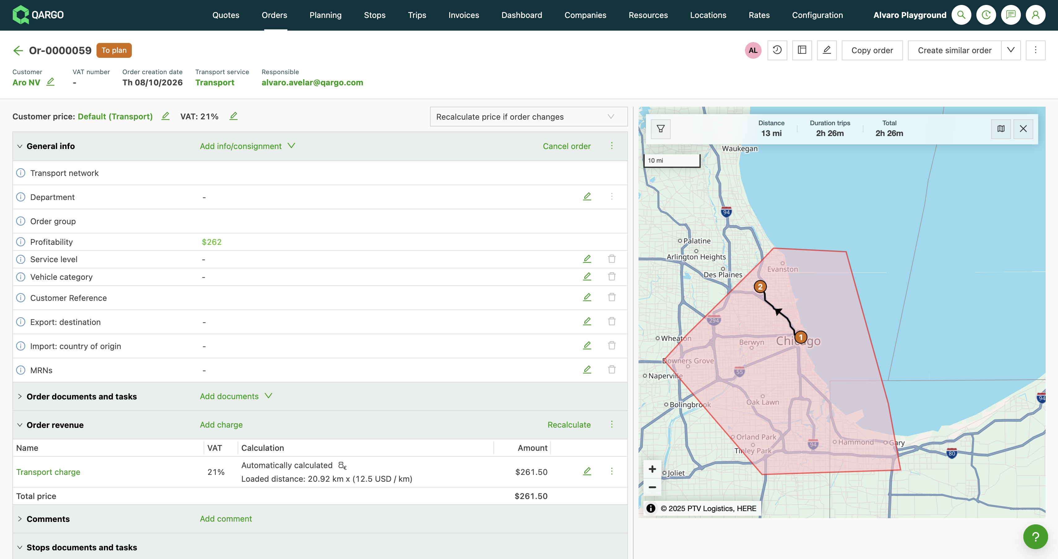
After saving, the route map in Load detail and Order detail shows the polygon geofence (the red outline) around every stop at this location.
To go back to a circle, select Circle, enter a radius in Trigger radius (meter) and save. To reset, clear the Geofence shape field with its x and save.
Location import: geofence columns
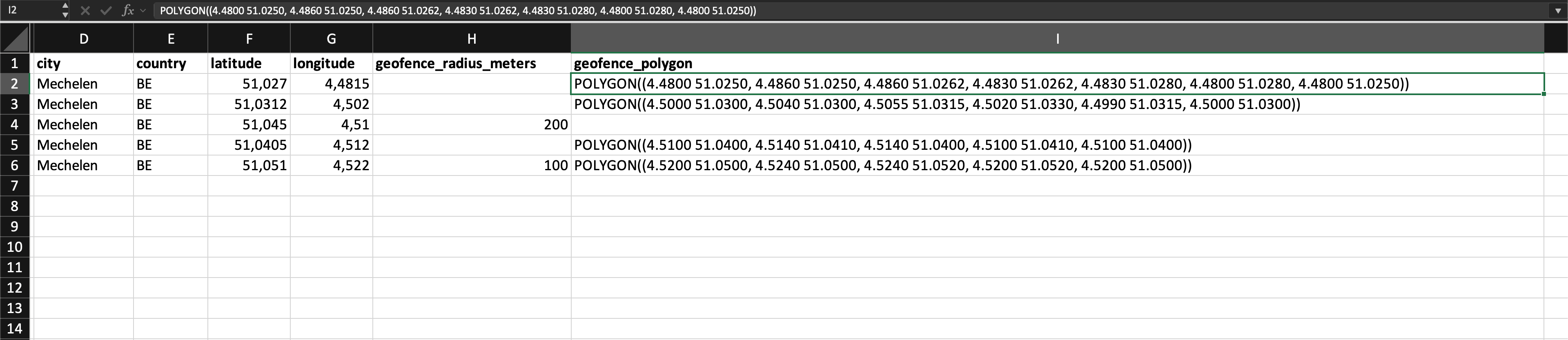
The location import file has two optional geofence columns. Fill in one of them per location to set a circle or an outline.
| Column | What to enter |
|---|---|
| geofence_radius_meters | Radius of the circle around the location, in meters. |
| geofence_polygon | Outline of the site, written as POLYGON((longitude latitude, longitude latitude, …)). |
Example of a geofence_polygon value:
POLYGON((4.4800 51.0250, 4.4860 51.0250, 4.4860 51.0262, 4.4830 51.0262, 4.4830 51.0280, 4.4800 51.0280, 4.4800 51.0250))
Import rules: what to know
- Closed outline: repeat the first corner at the end. The closing corner does not count toward the maximum of 40 corners.
- Checks: the import applies the same checks as the location screen. The outline needs 3 to 40 corners, edges that do not cross or touch, and the location pin inside.
- One outline: a location has one outline, with no holes and no second area.
- One shape per row: a row with both columns filled fails with an error on that row.
- Empty cells: an empty cell leaves the saved geofence unchanged.
- Changing shape: a filled cell switches the location to that shape. The saved shape of the other kind stays stored. A radius on a location with an outline makes it a circle. Switching back to Polygon restores the outline.
- Export: the export writes the same values under translated column labels, for the active shape only. An exported file cannot be imported back unchanged.
Limitations
-
Autocomplete only works if the previous stops were successfully completed.
- If the previous stop was not successfully completed, the geofencing times are still captured, but the arrival/departure is not autocompleted.
-
If autocomplete geofencing is used for departing from a stop, the stop is marked as completed.
- In the driver mobile app, question paths are not shown to the driver.
- The driver can manually go back to the completed stop to fill in the question paths.